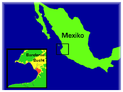
Nuevo Vallarta Area Map
Nearby Locations
- Sayulita
- Punta Mita
- Puerto Vallarta
- Mismaloya
- Yelapa
Nearby travel destinations and maps of Nuevo Vallarta.
To the south after 10 Minutes shows up the local airport Diaz Ordaz Puerto Vallarta. The small airport is situated in the center of the Banderas Bay and from everywhere easily accessible. 5 Minutes later the Puerto Vallarta harbor for private ships and cruisers is situated, the Puerto Vallarta Marina, which also features a selection of first class hotels and beach front resorts on a faboluos beach. Passing the Puerto Vallarta hotel zone after 10 minutes the traveler arrives at the Puerto Vallarta Old City, with its famous Malecon.
At walking distance is the important and cultural very interisting zone Vallartas, the Zona Romantica. This part of the city features the best restaurants, galleries, shops and attraktions of Puerto Vallarta. After the following private residential zones Conchads Chinas and Amapas the visitor leaves the city of Puerto Vallarta. 10 Minutes more to Mismaloya. The beaches Quimixto or Yelapa are only reachable by boat and worth a visit because of their unique beauty.
After Nuevo Vallarta follows the former fishers village Bucerias, well known for its privately owned casitas and its 3 mile long shelf water beach. From there its just 5 more minutes to La Cruz de Huanacaxtle, a village with upcoming tourism structure, now featuring its own marina. Several smaller beaches and hotel areas like Piedra Blanca and Destiladeras are on the way to Punta Mita, Well known for the Four Seasons Hotel and the pristine white sandy beaches. After Punta Mita the brilliant Litibu beach shows up. A few minutes later the surfers dreams comes true at Sayulita, the surfers paradise. At least the small and beautyful village of San Pancho or San Francisco needs to be mentioned.